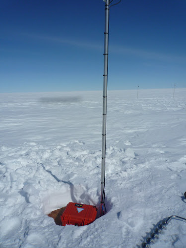
It took 10 hours skidoo driving across the path laid out by the Prinoth during the night, to arrive at the camp site on the ice shelf, near the grounding line. The camp is called RBIS1 and is at the site of the meteo station from the BENEMELT project (http://benemelt.blogspot.com). The first activity was to put the new ApRES (phase-sensitive radar) in place in one of the channels on the ice shelf. Data are collected regularly and transmitted automatically via Iridium. The next day was devoted to retrieving the GPS stations on the ice shelf (the so-called tweeting ice shelf -http://tweetiniceshelf.blogspot.com). Both systems stopped working due to battery failure, but they ran for one year, which was their design period. Unfortunately, since the expedition was delayed with one month and a half, we have to cope with the data gap. Both systems were successfully retrieved, dug out and repositioned. The antennas were still 1.5 meter above the snow surface. The relatively low accumulation is probably due to the wind action in this area of the channels. However, the flags that indicated their position were tilted or down on the snow surface. Luckily that the precise coordinates of the sites were known (thank you tweeting ice shelf!). Both systems are again transmitting data live. The old ApRES radar was also dug out. It took about 2 hours with 4 people to clear the job, but 1.5 gigabytes of data were recovered from the system. It is now used to remeasure all other points that were measured last year. All activities need to go swift, because a storm is expected on Monday. The purpose is now to move to Derwael ice rise as soon as possible and to retrieve the data from the geodetic GPS systems. All ApRES measurements across the ice divide also need to be done. So far, so good.

No comments:
Post a Comment